Mount Kenya National Park, a UNESCO World Heritage Site and Biosphere Reserve, is located on the eastern edge of Kenya's Central Highlands.
The park is centred on Mount Kenya, the country's highest mountain at 5,199 metres (17,057 ft) and the second-highest in Africa.
Main access points are situated approximately 193 kilometres (120 miles) northeast of Nairobi.
Size and Scope of Mount Kenya National Park
The park covers an area of 715 square kilometres (276 square miles).
Its territory is shared across five counties: Nyeri, Kirinyaga, Embu, Tharaka Nithi, and Meru.
This positioning means visitors can approach the mountain from multiple counties, each offering unique cultural insights surrounding the mountain ecosystem.
Essential Park Entry to Mount Kenya National Park
All visitors must adhere to the entry requirements stipulated by the Kenya Wildlife Service (KWS) and the national government.
This includes park fee payment. International visitors must secure the correct travel authorisation prior to arrival to ensure smooth entry.
Mount Kenya 2026 KWS Premium Park Rates
Mount Kenya is designated as a KWS Premium Park.
Entry fees are charged per person for each 24-hour period. This structure means visitors planning multi-day treks will pay for each day spent within the park boundaries.
Rates differ for Citizens, East African Residents, and Non-Resident international visitors.
Visitors must verify the most current fee schedule before travel. Fees are subject to revision, and checking in advance prevents unexpected costs.
Official Kenya Wildlife Service KWS Website
The official source for current park entry fees, park rules, and conservation updates is the Kenya Wildlife Service (KWS) website.
Visitors must consult this resource during their planning to ensure compliance and accurate budgeting.
Mandatory Electronic Travel Authorisation eTA Process
As of 2026, Kenya requires all international visitors to obtain an Electronic Travel Authorisation (eTA) prior to boarding their flight.
This electronic process replaces the previous visa system, simplifying entry procedures.
Applicants must submit their details through the official government portal. Allowing a minimum of 72 hours for processing ensures timely approval before travel.
International Visitor Entry Requirements
Beyond the eTA, international visitors must possess a passport valid for at least six months from the date of entry and with at least one blank page.
Immigration officials may also require proof of onward or return travel upon arrival at Jomo Kenyatta International Airport (NBO) or other ports of entry.
Accessing Mount Kenya National Park
Access is available via a well-established road network and regional airstrips.
The primary approach is by road from Nairobi, with several routes servicing the various park gates.
Updated Infrastructure Developments
A tarmac road circles the base of the Mount Kenya massif, reliably connecting the primary service towns of Nanyuki, Naro Moru, Embu, and Meru.
This allows for straightforward logistics and movement between different access points for trekkers and safaris.
New Tarmac Roads Access
While the main ring road is tarmac, the final access tracks leading to the park gates (e.g., Sirimon, Naro Moru, Chogoria) are unpaved.
A 4x4 vehicle is necessary, especially during wet seasons.
Confirming current road conditions with a tour operator or KWS ensures preparedness for potentially challenging terrain.
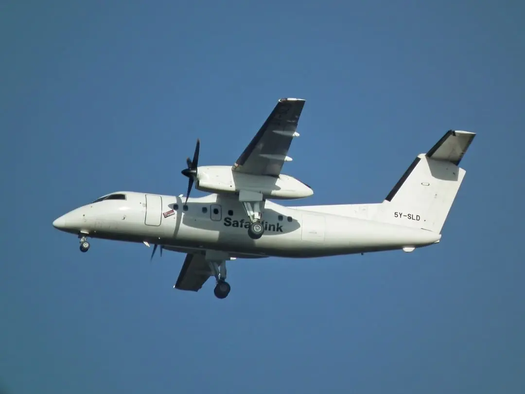
Operational Airstrips and Flights
Nanyuki Airport (NYK) is the closest commercial airfield, with daily scheduled flights from Wilson Airport (WIL) in Nairobi.
This provides a convenient air link for those wishing to reduce travel time from the capital.
Several private lodges and conservancies in the surrounding Laikipia region also operate their own private airstrips for charter flights. This offers direct and efficient access for guests.
Mount Kenya's Unique Ecosystems and Natural Wonders
Mount Kenya's significant altitude variation results in distinct ecological bands, each with characteristic flora and fauna.
This distinct zonation forms a key factor in its UNESCO designations.
Altitudinal Vegetation Zones of Mount Kenya
Ascending Mount Kenya reveals a clear progression through several vegetation zones.
These range from the rich forests at the base to the sparse life of the nival zone near the peaks, offering trekkers a dynamic shift in scenery and climate.
Lower Montane Forest Characteristics
The lower slopes, from approximately 2,000 to 2,500 metres, feature montane forest, rich in cedar (Juniperus procera) and podocarpus species.
This belt forms a critical habitat for the park's larger mammal populations, where species like elephants and buffalo find ample cover and forage.
Bamboo Zone Features
Above the forest, typically between 2,500 and 3,000 metres, lies a dense belt of bamboo (Yushania alpina).
This zone is frequently shrouded in mist, providing cover for species such as the elusive bongo antelope.
Trekkers passing through often feel the dense humidity and cool air characteristic of this unique environment.
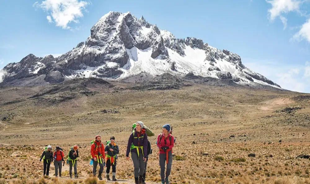
Afro-alpine Moorland Landscapes
From 3,000 to 4,500 metres, the landscape transitions into the Afro-alpine moorland.
This area is characterised by tussock grasses, heather, and unique giant plants adapted to the high-altitude environment, creating a distinctive, almost otherworldly, landscape.
Nival Zone Environment
Above 4,500 metres is the nival zone, a landscape of rock, scree, and glaciers.
Vegetation features hardy lichens and mosses which survive the extreme cold and high levels of ultraviolet radiation.
Rare Flora of Higher Altitudes
The Afro-alpine zone is recognised worldwide for its unique mega-flora, which have evolved in isolation on East Africa's highest mountains.
Giant Lobelias and Groundsels
The prominent plants of the moorlands are the giant groundsels (Dendrosenecio) and various species of giant lobelia (Lobelia).
These plants have specific adaptations, including water-storing rosettes and 'fur' coatings.
These features allow them to withstand nightly freezes and intense daytime sun.
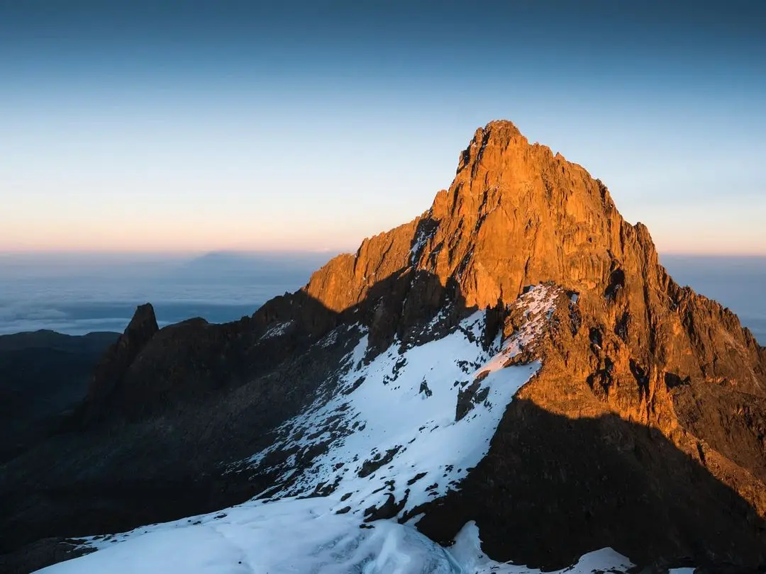
Main Peaks of Mount Kenya
The central massif of Mount Kenya features several jagged, glacier-clad peaks.
The three highest are technical climbs. Point Lenana is accessible to trekkers.
Batian Peak Altitude
Batian is the highest peak of Mount Kenya, standing at an altitude of 5,199 metres (17,057 ft).
Advanced rock climbing and mountaineering skills are necessary for summiting.
Nelion Peak Elevation
Nelion, at 5,188 metres (17,021 ft), is the second-highest peak.
It is a technical climb. Ascents are often made in conjunction with Batian via the "Gate of the Mists" traverse.
Point Lenana Height
Point Lenana is the third-highest peak at 4,985 metres (16,355 ft).
It is the primary objective for most trekkers, accessible via non-technical hiking routes like Naro Moru, Sirimon, and Chogoria.
Prominent Glacial Lakes of Mount Kenya
The high-altitude valleys, carved by past glaciation, hold numerous tarns and glacial lakes.
These bodies of water are a key feature of the park's alpine scenery.
Lake Michaelson Views
Located in the Gorges Valley along the Chogoria route, Lake Michaelson is known for its dramatic setting beneath sheer rock faces.
Its deep blue waters and unique location make it a prime photographic subject for those seeking dramatic alpine vistas.
Lake Alice Serenity
Situated at a higher altitude, Lake Alice is a large alpine lake.
It offers opportunities for trout fishing and panoramic views of the surrounding peaks. This provides a tranquil high-altitude experience.
Lake Ellis Scenery
Found along the Chogoria route at a lower altitude, Lake Ellis is one of the more accessible lakes within the park.
It is set in a wide moorland valley and is a popular camping spot. Its accessibility makes it a common stop for trekkers on the Chogoria route.
Wildlife Residents of Mount Kenya National Park
The park's diverse habitats support a wide range of animal species.
Many are shy and difficult to observe due to the dense forest cover.
Forest and Moorland Ecosystem Species
The lower forest belts contain the highest density of wildlife.
As altitude increases, species composition changes, with only the hardiest animals found in the upper moorlands.
This means sightings of large mammals are more common in the lower forest belts.
Forest Elephant Sightings
The park is home to a notable population of forest elephants.
Forest elephants, smaller than their savannah counterparts, typically reside within the dense montane and bamboo forests.
Observing them requires patience and often a dedicated forest walk.
Buffalo Herds
Cape buffalo are common in the forest and lower moorland zones.
These formidable herbivores are frequently sighted on game drives or from the vantage points of mountain lodges.
Colobus Monkey Habitats
The black-and-white colobus monkey is a visible resident of the montane forest canopy.
Their long white tails make them easily identifiable against the green foliage as they move gracefully through the trees.
Bongo Antelope Presence
Mount Kenya's forests are an important habitat for the rare, elusive bongo, a large, striped forest antelope.
Infrequent sightings make an encounter with this shy mammal a highly prized moment for any visitor, often requiring luck and expert guiding.
Endemic Bird Species
The park is an Important Bird Area (IBA), with over 130 recorded species.
This includes several endemic and near-endemic species adapted to the high-altitude environment, providing excellent birdwatching opportunities for those keen to spot unique avifauna like the Abyssinian ground thrush and Jackson's francolin.
Mount Kenya's Global Status
The international community has recognised the ecological and geological value of Mount Kenya through two key UNESCO designations.
UNESCO World Heritage Site Recognition
In 1997, Mount Kenya National Park/Natural Forest was inscribed as a UNESCO World Heritage Site.
The designation acknowledges its status as a prominent landscape in East Africa.
Its rugged glacier-clad summits, Afro-alpine moorlands, and diverse forests demonstrate key ecological processes, offering a distinct visual experience for all visitors.
UNESCO Biosphere Reserve Importance
The area was designated a UNESCO Biosphere Reserve in 1978.
This status emphasises the mountain's importance as a water tower for Kenya.
It provides fresh water to a large portion of Kenya's population and its agricultural sector, directly supporting livelihoods.
The designation also recognises the need to balance conservation with sustainable human activity in the surrounding areas, highlighting a commitment to long-term ecological health.
Key Mount Kenya Peaks Comparison
| Peak Name | Altitude (Metres / Feet) | Climbing Difficulty | Typical Access |
|---|---|---|---|
| Batian | 5,199 m (17,057 ft) | Advanced Rock Climbing / Mountaineering | Technical routes only |
| Nelion | 5,188 m (17,021 ft) | Technical Rock Climbing / Mountaineering | Technical routes, often combined with Batian |
| Point Lenana | 4,985 m (16,355 ft) | Trekking (Non-Technical) | Naro Moru, Sirimon, Chogoria routes |
Best Time to Visit Mount Kenya National Park
Optimal periods for visiting Mount Kenya National Park align with the dry seasons.
The primary windows for trekking and climbing are January to February and July to early October.
During these months, weather conditions are generally clearer and drier. This provides safer climbing conditions and superior visibility of the peaks and surrounding landscape.
Rainy seasons, typically March to June (long rains) and October to December (short rains), result in challenging, muddy conditions on the trails and increased cloud cover.